
e-TOD
Addtime:2014-11-17 10:57
E-TOD
——Electronic Terrain and Obstacles Database
Electronic Terrain and Obstacles Database
IDS’s E-TOD suite of software tools is designed to manageairport, terrain and obstacle data ensuring compliance with international data quality requirements (ICAO Annex 15,Amendments 33, 34 and 36).
Its main functionalities include data administration,reporting and processing, making all elements available for modeling airport areas and ICAO obstacle chart construction and delivery.
A proper database structure (TOD, Terrain and Obstacle Database) able to support all activities provides a common basis either to perform aeronautical charting or to design airspace and flight procedures within the FPDAM interactive environment.
E-TOD is composed of three main modules, Survey Data Manager, Airport Data Analyzer and Obstacle Chart Builder,which can be used with IDS’s Aeronautical Information Services system either individually or in combination
Survey Data Manager
The Survey Data Manager provides all the necessary tools to import, integrate, manage and deliver aerodrome mapping information, obstacle data and terrain data in accordance with ICAO Doc 9881 and ICAO Annex 15 Amendment 36.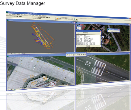
The system is able to assist the user in managing the lifecycle of data, validating and detecting ambiguous and conflicting data as well as with data export and reporting.Survey Data Manager is able to import several different types of data:
• Digital terrain models (DTM, DSM)
• Orthophotos
• Raster files
• Three-dimensional vector maps
• Raw survey data lists
All data undergo several validation checks during importation, a CRC (Cyclic Redundancy Check) code is computed to ensure data integrity, data are provided with metadata as required by ICAO Annex 15 and are then presented to the user via a graphical front end. All data and metadata are editable and the system maintains data consistency in the case of concurrent revisioning.
Airport Data Analyzer
IDS’s E-TOD Airport Data Analyzer provides all the tools necessary to import the airport, obstacle and terrain data needed to reproduce the airport environment and conduct natural or human made obstacle assessment.
Based on a Bentley Microstation CAD platform, it is able to export all of its output in a GIS environment and allows the user to display it in a common GIS platform or Google Earth.
The Airport Data Analyzer allows the user to review the input data and to use them for ICAO Annex 4 and 14 surfaces construction and for obstacle interference evaluations for both existing and planned obstacles.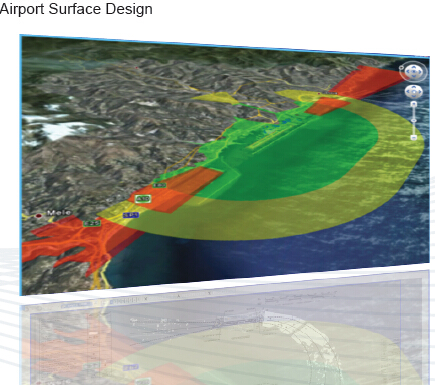
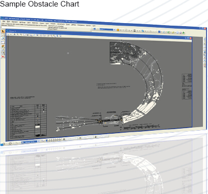
Obstacle Chart Builder
IDS’s E-TOD Obstacle Chart Builder provides all the necessary tools to extract obstacle and terrain information needed to create obstacle and terrain charts (ICAO typeA, B and PATC). It allows the user to manage and define chart templates within a graphical environment and to modify the following parameters:
• Header, profile view and plan view size and position
• Size and position of boxes
• Text size, color and font for each box element
• Elements to be represented
Once created, charts can then be inserted into the central database from where any system user can later retrieve them using a number of different search criteria (date of issue, classification, ICAO code, etc.) and then display them with a single click.
Prev:EMACS
Next:None